
LandSentry 國土巡守隊
國土利用監測點位追蹤

國土利用監測點位追蹤
國土巡守隊是一款 Android 應用程式,由網頁版國土利用監測地圖延伸開發而成,用於下載國土利用監測變異點資料,並在本地追蹤與記錄每個點位的狀態變化。資料來源為內政部國土利用監測整合資訊網,所有追蹤紀錄儲存於裝置本地。
LandSentry is an Android app extended from the land-use monitoring web map, for downloading land-use change detection points and locally logging/tracking the status of each point. Data comes from the National Land Use Monitoring information system (Ministry of the Interior). All tracking records are stored locally on the device.
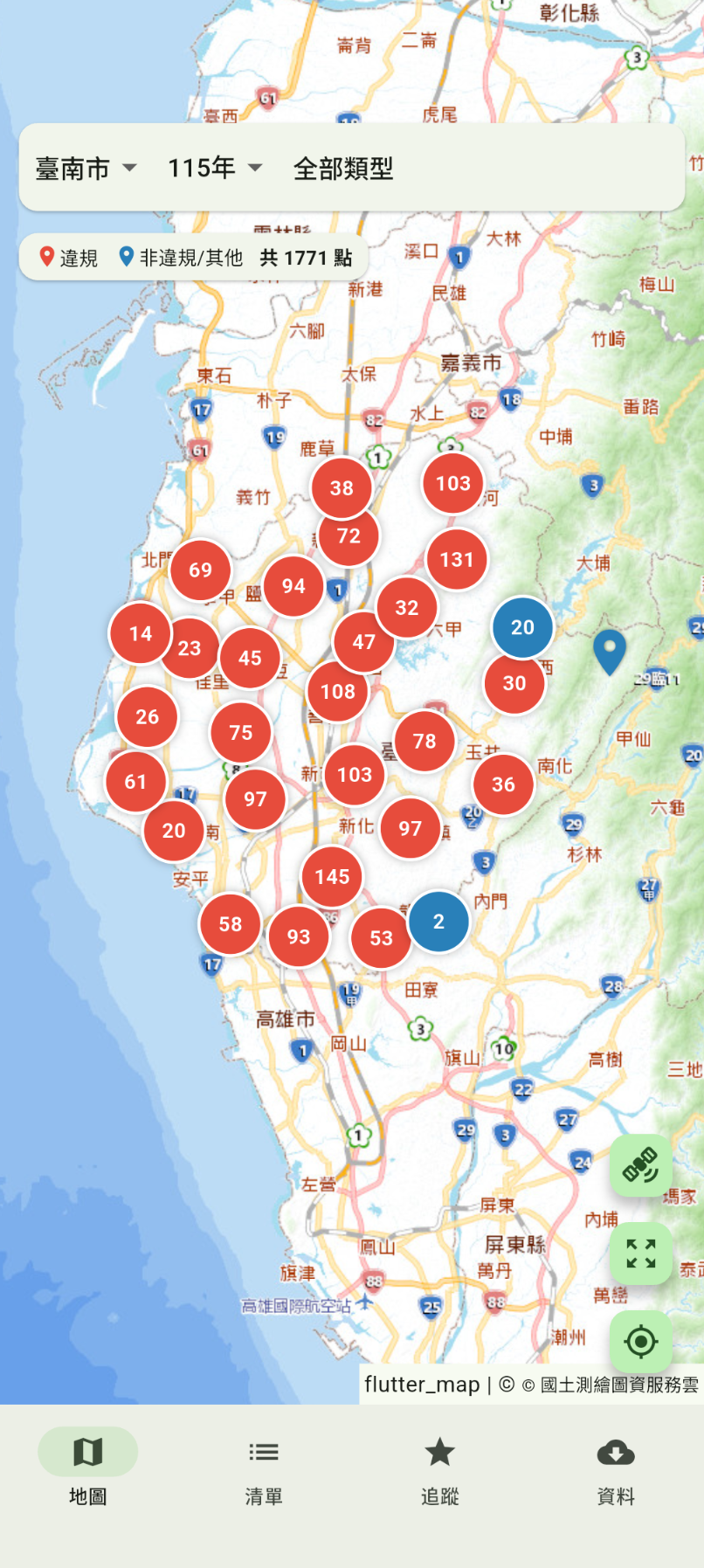
聚合標記地圖,紅色為違規案件
Clustered map view, red for violations
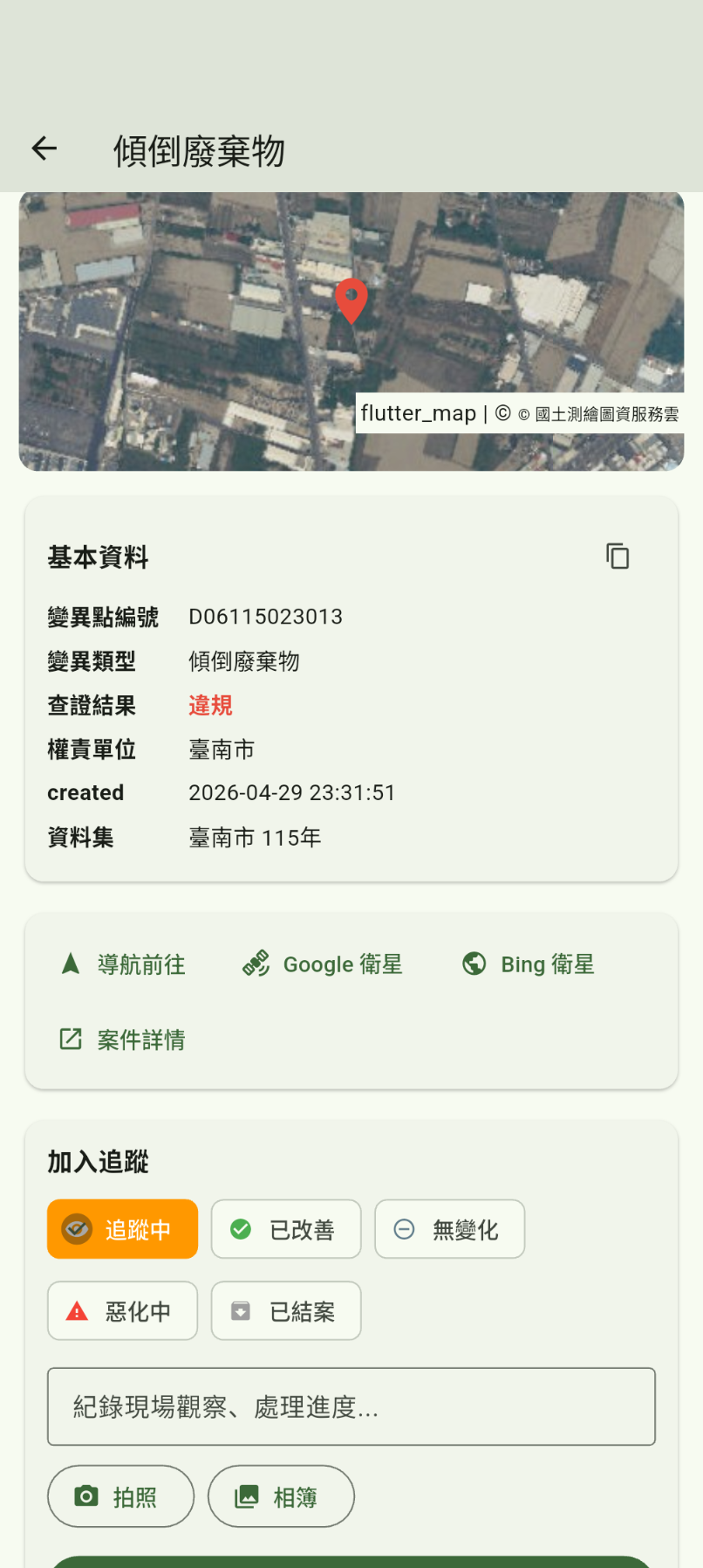
點位詳情與追蹤狀態設定
Point detail with tracking status
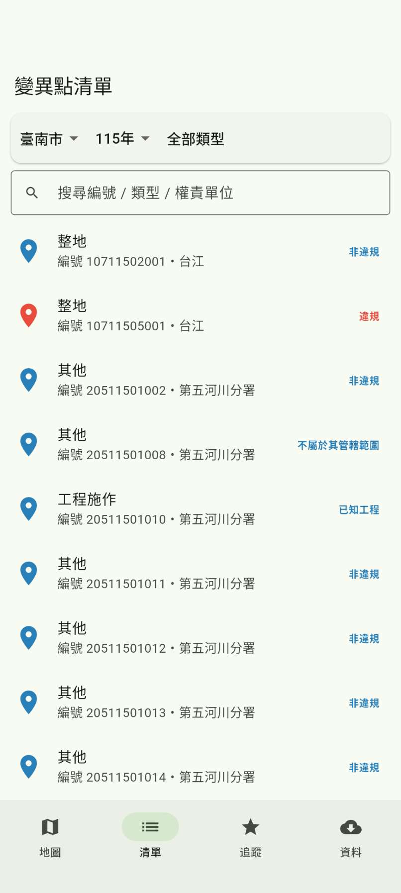
可搜尋篩選的變異點清單
Searchable point list with filters
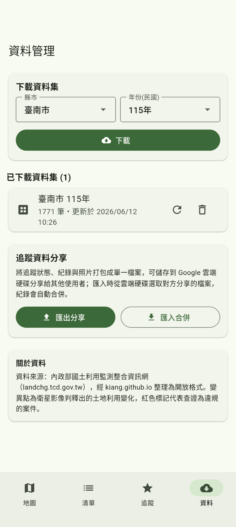
依縣市與年度下載資料集
Download datasets by city and year
監測點位資料來自內政部國土利用監測整合資訊網,以 CSV 格式依縣市與年度提供。應用程式下載後儲存於本地 SQLite 資料庫。
Monitoring point data is sourced from the National Land Use Monitoring System (Ministry of the Interior), provided as CSV files by city and year. The app downloads and stores them in a local SQLite database.
本應用程式不使用 Google OAuth,不存取任何 Google 帳號資料。
This app does not use Google OAuth and does not access any Google account data.
聯絡信箱 Contact: [email protected]
隱私權政策 Privacy Policy: privacy.html